Plantview is an intuitive software platform for visually organizing, viewing, annotating, making measurements and sharing 3D laser scans, 360° panorama images, photos and documents.
Due to a breakthrough in PVZ compression technology, for example a full resolution scan of 45M points can now be fully saved to a 30MB file. As a result, for 25€ per month it is now possible for everybody to use and share point clouds in a very efficient and competitive manner.

We were excited to be exhibiting at the UK’s largest geospatial event. Join us to see our latest products and services, experience the technology first-hand and get expert advice from our team.
3D Laser Scanning
Reality Capture
Industrial Facilities
Architects & Construction
Marine
Infrastructure
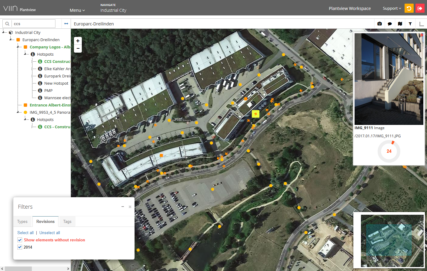
Use dynamic site maps (layouts and maps) to keep your scan project up to date
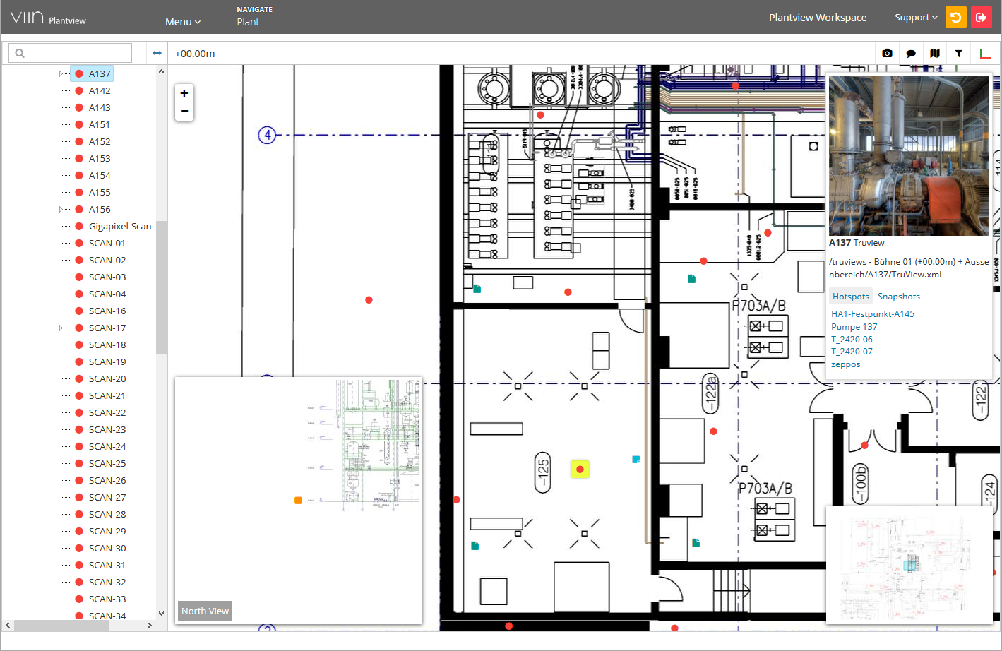
Structure, organize and view 3D laser scans (Leica, Z&F, Faro, Riegl, Trimble, Topcon)
Automatically position or update scans with only a few clicks
Create virtual tours and navigate between scans and panoramas
Keep your virtual tour up-to-date with dynamic site maps
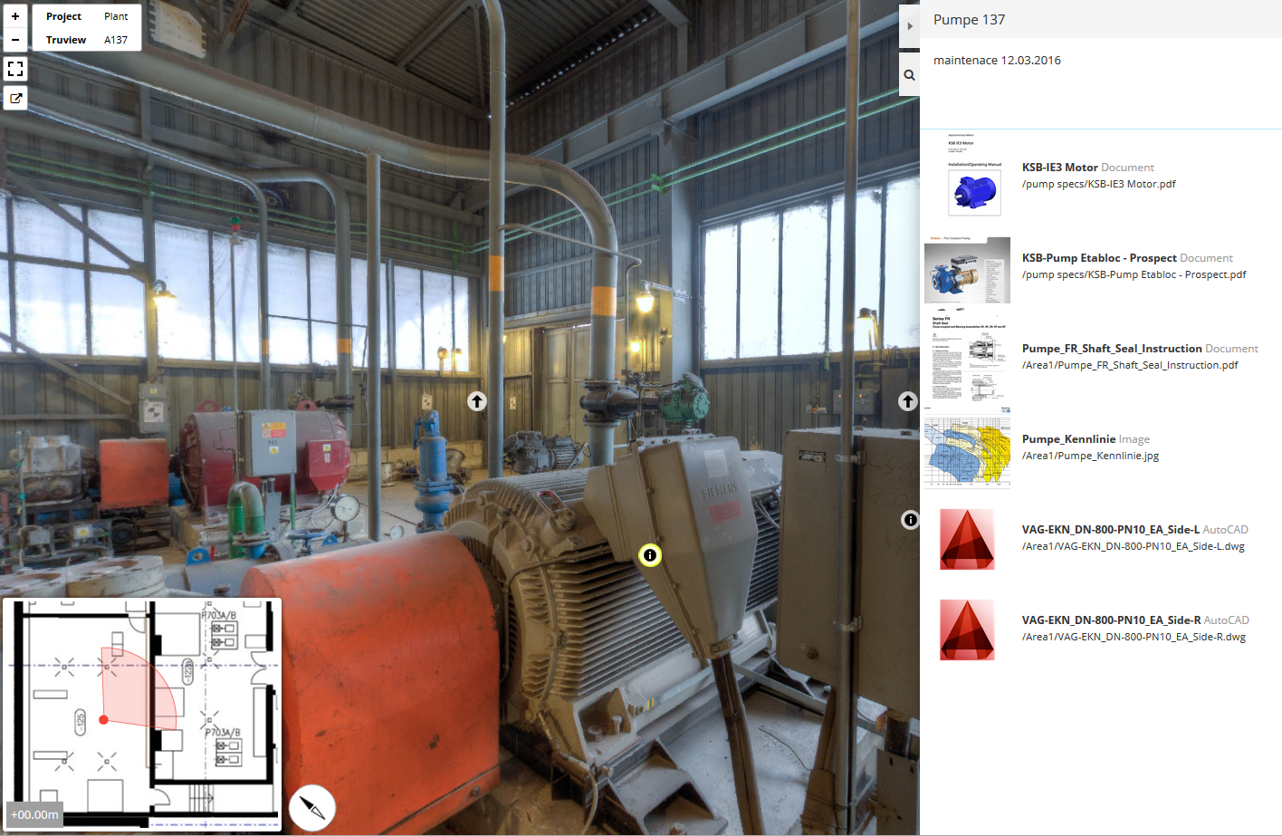
Integrate and update comments and document attachments
Place panoramas and photos with GPS orientation on your drawings or map
Communicate your photos, panoramas and comments with others
Visually organize and categorize comments on your imaging
Place rich text hotspots with document attachment on panoramas, scans or photos
Organize, find your hotspots and comments using revisions, tags and filters
Search documents and hotspots through the integrated database
Export and import projects for off-line use with the free viewer
Share and update project data and comments offline or with the online sync option
No internet or intranet connection needed to view projects
Documents are stored locally and remain on your computers
Option to sync data through your own storage (SFTP, FTP, Dropbox)
AES-256 bit end-to-end encryption